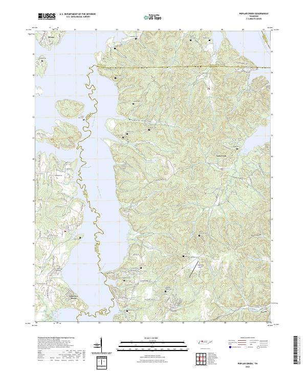
2022 Map of Poplar Creek
USGS Topo · Published 2022About this map
The broad waters of Kentucky Lake and the Big Sandy River define this modern look at the borderlands of Henry and Benton counties. This landscape is a complex network of inlets and hollows, where water-access developments like Lakeview Manor contrast with the area's deep agricultural and family roots. Numerous small family and community burial grounds, such as Beaton Cem, Dortch Cem, and Stockdale Cem, are preserved across the ridges, providing essential data for genealogists tracking local lineages. The map captures the infrastructure supporting this river economy, from the Big Sandy Airpark to the small settlement of Faxon near the southeastern corner. Terrain features like McSwain Hollow and Homer Hollow illustrate the varied topography that funnels into the Tennessee River system, while roads like Wynn Ferry Rd point to historical crossing points used long before the modern reservoir was created.
Find a feature on this map
109 named features on this map. Tap any name to fly to it.
Don’t see what you’re looking for? This feature index may not catch every label — zoom into the map to look around manually.
Map Details
Editions of this 2022 Poplar Creek Map
This is the sole edition of this map. No revisions or reprints were ever made.
Other maps of this area

1936 · Poplar Creek
USGS Topo · 1:24,000

1936 · Buchanan
USGS Topo · 1:24,000

1936 · McKinnon
USGS Topo · 1:24,000

1936 · Big Sandy
USGS Topo · 1:24,000

1936 · Centerville Landing
USGS Topo · 1:24,000

1936 · Harmon Creek
USGS Topo · 1:24,000

1936 · Standing Rock
USGS Topo · 1:24,000

1936 · Manleyville
USGS Topo · 1:24,000

1936 · Springville
USGS Topo · 1:24,000

1938 · Springville
USGS Topo · 1:24,000