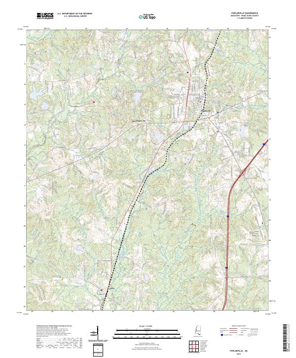
2024 Map of Poplarville
USGS Topo · Published 2024About this map
The Pearl River County Courthouse serves as a central landmark for this area of southern Mississippi, where the seat of Poplarville is characterized by its organized street grid and educational presence. The Pearl River Community College Poplarville Campus dominates the western side of the town center, illustrating the long-standing role of local academic institutions in the region's development. Further west, the settlement of West Poplarville branches out toward the drainages of Mill Creek and Jumpoff Creek, while the community of Derby sits to the south near the banks of Cypress Creek. The landscape is defined by a dense network of local roads and family-named routes such as Charles Keller Rd and Floyd Moody Rd, which weave through the timber-rich terrain and numerous small tributaries like Beaverdam Creek and Juniper Creek. This survey captures the modern infrastructure of the county, including the Poplarville/Pearl River County Airport.
Find a feature on this map
119 named features on this map. Tap any name to fly to it.
Don’t see what you’re looking for? This feature index may not catch every label — zoom into the map to look around manually.
Map Details
Editions of this 2024 Poplarville Map
This is the sole edition of this map. No revisions or reprints were ever made.
Other maps of this area

1953 · Mobile
USGS Topo · 1:250,000

1955 · Savannah
USGS Topo · 1:62,500

1957 · Mobile
USGS Topo · 1:250,000

1958 · Carnes
USGS Topo · 1:62,500

1958 · Picayune
USGS Topo · 1:62,500

1959 · Poplarville
USGS Topo · 1:62,500

1960 · Mobile
USGS Topo · 1:250,000

1963 · Mobile
USGS Topo · 1:250,000

1965 · Mobile
USGS Topo · 1:250,000
1982 · Savannah
USGS Topo · 1:24,000