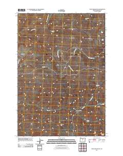
2011 Map of Porcupine Butte
USGS Topo · Published 2011About this map
Knox Ranch serves as a central landmark in this high-desert landscape of Wheeler County, where drainage networks define the terrain of the West Fork Butte Creek. The topography is etched with deep canyons and gulches, including Happy Jack Canyon to the north and Robinson Canyon further south. These features reveal a rugged geography shaped by seasonal water flow, with named water sources like Coates Spring and Starr Spring indicating critical points of hydration in an otherwise arid environment.
Find a feature on this map
20 named features on this map. Tap any name to fly to it.
Don’t see what you’re looking for? This feature index may not catch every label — zoom into the map to look around manually.
Map Details
Editions of this 2011 Porcupine Butte Map
This is the sole edition of this map. No revisions or reprints were ever made.
Other maps of this area

1916 · Condon
USGS Topo · 1:125,000

1926 · Mitchell
USGS Topo · 1:125,000

1953 · The Dalles
USGS Topo · 1:250,000

1955 · Bend
USGS Topo · 1:250,000

1956 · The Dalles
USGS Topo · 1:250,000

1957 · Bend
USGS Topo · 1:250,000

1957 · The Dalles
USGS Topo · 1:250,000

1958 · Bend
USGS Topo · 1:250,000

1966 · Kinzua
USGS Topo · 1:62,500

1966 · Clarno
USGS Topo · 1:62,500