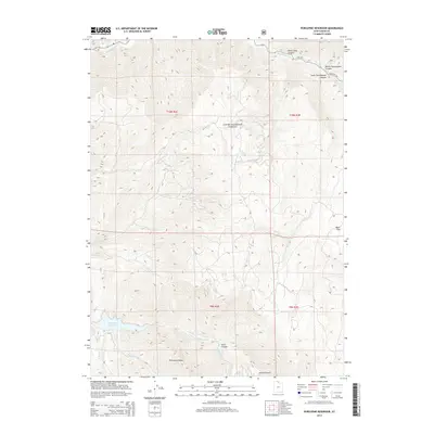
2014 Map of Porcupine Reservoir
USGS Topo · Published 2014About this map
Cache National Forest defines the high-altitude landscape of this 2014 survey, where the convergence of several major drainage systems shapes the topography. The western edge is dominated by Porcupine Reservoir, a significant water body fed by Porcupine Cr and the E Fork Little Bear River. The intricate canyon systems, including Devils Gate Canyon and Scare Canyon, demonstrate the complex erosion patterns common in the northern Wasatch Range. Transport into these high basins is dictated by the watercourses, with E Hwy 101 following the path of the Blacksmith Fork river. This map provides a clear view of the wilderness interface where public forest lands meet vital water management infrastructure, documenting landmarks such as Porcupine Ridge and the high vantage of Mineral Point for modern land use and historical reference.
Find a feature on this map
21 named features on this map. Tap any name to fly to it.
Don’t see what you’re looking for? This feature index may not catch every label — zoom into the map to look around manually.
Map Details
Editions of this 2014 Porcupine Reservoir Map
This is the sole edition of this map. No revisions or reprints were ever made.
Other maps of this area

1914 · Logan
USGS Topo · 1:125,000

1916 · Logan
USGS Topo · 1:125,000

1949 · Boulter Mts
USGS Topo · 1:24,000

1954 · Ogden
USGS Topo · 1:250,000

1955 · Paradise
USGS Topo · 1:24,000

1955 · James Peak
USGS Topo · 1:24,000

1958 · Ogden
USGS Topo · 1:250,000

1960 · Ogden
USGS Topo · 1:250,000

1961 · Logan
USGS Topo · 1:24,000

1964 · Monte Cristo PK
USGS Topo · 1:24,000