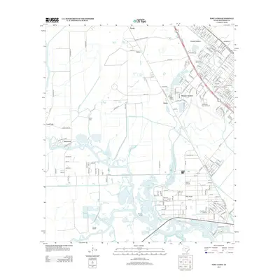
2013 Map of Port Acres
USGS Topo · Published 2013About this map
Taylor Bayou and its winding tributaries, including Snake Bayou and Tiger Bayou, define the southern wetland landscape of this Jefferson County area. The interaction between human development and the marshy terrain is evident in the extensive canal system, featuring the Porte Arthur Canal, Garner Canal, and Gallier Canal which cut through the coastal plains. Significant local landmarks such as Jack Brooks Regional Airport and the sprawling Forest Lawn Memorial Park serve as central anchors for the surrounding residential communities.
Find a feature on this map
192 named features on this map. Tap any name to fly to it.
Don’t see what you’re looking for? This feature index may not catch every label — zoom into the map to look around manually.
Map Details
Editions of this 2013 Port Acres Map
This is the sole edition of this map. No revisions or reprints were ever made.
Other maps of this area

1926 · Terry
USGS Topo · 1:24,000

1926 · Vidor
USGS Topo · 1:24,000

1932 · Beaumont
USGS Topo · 1:62,500

1943 · Port Arthur North
USGS Topo · 1:24,000

1943 · Terry
USGS Topo · 1:24,000

1943 · Port Arthur South
USGS Topo · 1:24,000

1943 · Fannett East
USGS Topo · 1:24,000

1943 · Beaumont East
USGS Topo · 1:24,000

1945 · Fannett East
USGS Topo · 1:31,680

1950 · Houston
USGS Topo · 1:250,000