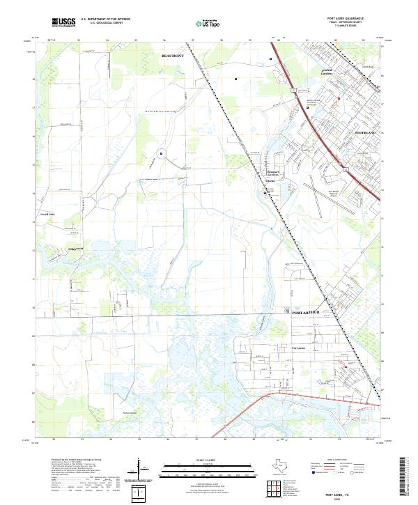
2022 Map of Port Acres
USGS Topo · Published 2022About this map
The coastal wetlands and industrial corridors south of Beaumont define this portion of Jefferson County. The landscape is a complex network of drainage and transportation, where the Port Arthur Canal and Taylor Bayou cut through low-lying terrain near French Island. Residential clusters like Port Acres and Beauxart Gardens are situated alongside heavy infrastructure, including the Jack Brooks Regional Airport and the sprawling petroleum-linked areas near Smith Bluff. Local history is anchored by sites such as the Memory Gardens of Jefferson County Cem and Live Oak Memorial Park.
Find a feature on this map
48 named features on this map. Tap any name to fly to it.
Don’t see what you’re looking for? This feature index may not catch every label — zoom into the map to look around manually.
Map Details
Editions of this 2022 Port Acres Map
This is the sole edition of this map. No revisions or reprints were ever made.
Other maps of this area

1926 · Terry
USGS Topo · 1:24,000

1926 · Vidor
USGS Topo · 1:24,000

1932 · Beaumont
USGS Topo · 1:62,500

1943 · Port Arthur North
USGS Topo · 1:24,000

1943 · Terry
USGS Topo · 1:24,000

1943 · Port Arthur South
USGS Topo · 1:24,000

1943 · Fannett East
USGS Topo · 1:24,000

1943 · Beaumont East
USGS Topo · 1:24,000

1945 · Fannett East
USGS Topo · 1:31,680

1950 · Houston
USGS Topo · 1:250,000