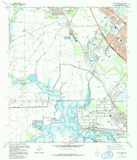
1993 Map of Port Acres
USGS Topo · Published 1994About this map
Spindletop and the surrounding coastal plains of Jefferson County defined this era of Texas industrial development. The landscape is a dense network of energy infrastructure, where the Lovell Lake Oil Field and Beaumont Field are crisscrossed by countless pipelines and pumping stations. This industrial footprint sits alongside established residential areas like Nederland and Port Acres, illustrating the close proximity of oil production to local life.
Find a feature on this map
51 named features on this map. Tap any name to fly to it.
Don’t see what you’re looking for? This feature index may not catch every label — zoom into the map to look around manually.
Map Details
Editions of this 1993 Port Acres Map
This is the sole edition of this map. No revisions or reprints were ever made.
Other maps of this area

1926 · Terry
USGS Topo · 1:24,000

1926 · Vidor
USGS Topo · 1:24,000

1932 · Beaumont
USGS Topo · 1:62,500

1943 · Port Arthur North
USGS Topo · 1:24,000

1943 · Terry
USGS Topo · 1:24,000

1943 · Port Arthur South
USGS Topo · 1:24,000

1943 · Fannett East
USGS Topo · 1:24,000

1943 · Beaumont East
USGS Topo · 1:24,000

1945 · Fannett East
USGS Topo · 1:31,680

1950 · Houston
USGS Topo · 1:250,000