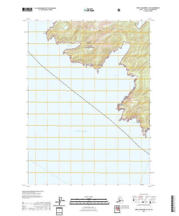
2021 Map of Port Alexander A-3 NE
USGS Topo · Published 2021About this map
Baranof Island serves as the focal point of this coastal survey, where the dense topography of the Alexander Archipelago meets the open waters of the Gulf of Alaska. The landscape is characterized by sharp coastal indentations and prominent maritime landmarks, including the high elevation of Ommaney Peak and the southern reach of Cape Ommaney. These features define the edge of the Tongass National Forest, illustrating a shoreline defined by deep bays like Little Puffin Bay and Larch Bay that have long provided shelter and navigation points for mariners. The map reveals the intricate shoreline of the Sitka City and Borough, where landforms such as Bobrovoi Point and Puffin Point mark the transition from protected inlets to the exposed Pacific.
Find a feature on this map
16 named features on this map. Tap any name to fly to it.
Don’t see what you’re looking for? This feature index may not catch every label — zoom into the map to look around manually.
Map Details
Editions of this 2021 Port Alexander A-3 NE Map
This is the sole edition of this map. No revisions or reprints were ever made.
Other maps of this area

1948 · Port Alexander A-2
USGS Topo · 1:63,360
1948 · Port Alexander A-3
USGS Topo · 1:63,360

1948 · Port Alexander B-2
USGS Topo · 1:63,360

1951 · Port Alexander B-3 and B-4
USGS Topo · 1:63,360

1951 · Port Alexander
USGS Topo · 1:250,000

1951 · Port Alexander B-2
USGS Topo · 1:63,360
1951 · Port Alexander A-3
USGS Topo · 1:63,360
1951 · Port Alexander A-2
USGS Topo · 1:63,360

1952 · Port Alexander
USGS Topo · 1:250,000

1964 · Port Alexander
USGS Topo · 1:250,000