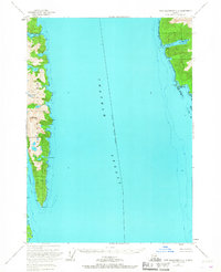
1951 Map of Port Alexander C-2
USGS Topo · Published 1967About this map
Chatham Strait divides this coastal Alaska landscape, separating the eastern shores of Baranof Island from the rugged coastline of Kuiu Island. In the early 1950s, the maritime industry of the region was concentrated at Washington Bay, where the Herring Reduction Plant and a dedicated Seaplane Base served as local hubs of activity. These features, along with the Washington Bay Light, highlight a period when seasonal industrial operations were vital to the economy of the Tongass National Forest.
Find a feature on this map
17 named features on this map. Tap any name to fly to it.
Don’t see what you’re looking for? This feature index may not catch every label — zoom into the map to look around manually.
Map Details
Editions of this 1951 Port Alexander C-2 Map
3 editions found
Other maps of this area

1948 · Port Alexander C-1
USGS Topo · 1:63,360

1948 · Port Alexander B-1
USGS Topo · 1:63,360

1948 · Port Alexander D-1
USGS Topo · 1:63,360

1948 · Port Alexander B-2
USGS Topo · 1:63,360

1951 · Port Alexander C-2
USGS Topo · 1:63,360

1951 · Port Alexander B-3 and B-4
USGS Topo · 1:63,360

1951 · Port Alexander C-3
USGS Topo · 1:63,360

1951 · Port Alexander D-3
USGS Topo · 1:63,360

1951 · Port Alexander
USGS Topo · 1:250,000

1951 · Port Alexander D-2
USGS Topo · 1:63,360