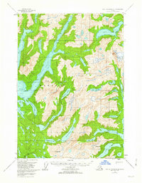
1951 Map of Port Alexander C-3
USGS Topo · Published 1962About this map
Baranof Island is defined by a complex network of glacial fjords and high-altitude lakes in this mid-century topographic study. The landscape is dominated by narrow waterways such as Great Arm and Small Arm, which penetrate deep into the mountainous interior toward summits like Mt Yanovski and Mt Ada. These coastal inlets provided critical maritime access for the small camps and stations documented here, including Makovo, Lars, and Net.
Find a feature on this map
47 named features on this map. Tap any name to fly to it.
Don’t see what you’re looking for? This feature index may not catch every label — zoom into the map to look around manually.
Map Details
Editions of this 1951 Port Alexander C-3 Map
2 editions found
Other maps of this area

1948 · Port Alexander B-2
USGS Topo · 1:63,360

1951 · Port Alexander C-4
USGS Topo · 1:63,360

1951 · Port Alexander D-4
USGS Topo · 1:63,360

1951 · Port Alexander C-2
USGS Topo · 1:63,360

1951 · Port Alexander B-3 and B-4
USGS Topo · 1:63,360

1951 · Port Alexander C-3
USGS Topo · 1:63,360

1951 · Port Alexander D-3
USGS Topo · 1:63,360

1951 · Port Alexander
USGS Topo · 1:250,000

1951 · Port Alexander D-2
USGS Topo · 1:63,360

1951 · Port Alexander B-2
USGS Topo · 1:63,360