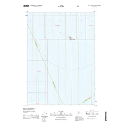
2020 Map of Port Alexander D-2 NW
USGS Topo · Published 2020About this map
Yasha Island sits as a solitary landmark in the expansive waters of Chatham Strait, a defining maritime corridor in Southeast Alaska. This map illustrates the intersection of several significant administrative boundaries, where the Sitka City and Borough meets the Hoonah-Angoon Census Area and the Prince of Wales-Hyder Census Area. The landmass of the island is protected as part of the Tongass National Forest, representing the maritime edge of the nation's largest national forest. The chart provides a precise look at these aquatic borders and the isolated terrain of the island before the vast open reach of the strait, documenting the modern jurisdictional lines that govern these remote coastal waters.
Find a feature on this map
5 named features on this map. Tap any name to fly to it.
Don’t see what you’re looking for? This feature index may not catch every label — zoom into the map to look around manually.
Map Details
Editions of this 2020 Port Alexander D-2 NW Map
This is the sole edition of this map. No revisions or reprints were ever made.
Other maps of this area

1948 · Sitka A-3
USGS Topo · 1:63,360

1948 · Sitka A-2
USGS Topo · 1:63,360

1951 · Sitka
USGS Topo · 1:250,000

1951 · Port Alexander D-3
USGS Topo · 1:63,360

1951 · Port Alexander
USGS Topo · 1:250,000

1951 · Port Alexander D-2
USGS Topo · 1:63,360

1951 · Sitka A-2
USGS Topo · 1:63,360
1951 · Sitka A-3
USGS Topo · 1:63,360

1952 · Port Alexander
USGS Topo · 1:250,000

1952 · Sitka
USGS Topo · 1:250,000