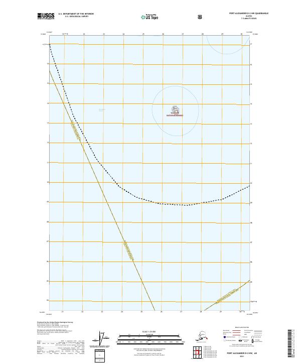
2021 Map of Port Alexander D-2 NW
USGS Topo · Published 2021About this map
Chatham Strait dominates this maritime expanse, where the deep waters of the Alexander Archipelago meet the administrative boundaries of Southeast Alaska. The map centers on the isolated Yasha Island, a small landmass within the Tongass National Forest that serves as a critical navigation marker for vessels moving through the strait. This 2021 study meticulously delineates the convergence of three major jurisdictions: the Hoonah-Angoon Census Area Sitka City and Borough, the Hoonah-Angoon Census Area Prince of Wales-Hyder Census Area, and the southern reaches of the Tongass National Forest. The absence of developed roads or settlements emphasizes the remote, water-dependent nature of this region, which remains primarily a corridor for maritime traffic and wilderness management.
Find a feature on this map
9 named features on this map. Tap any name to fly to it.
Don’t see what you’re looking for? This feature index may not catch every label — zoom into the map to look around manually.
Map Details
Editions of this 2021 Port Alexander D-2 NW Map
This is the sole edition of this map. No revisions or reprints were ever made.
Other maps of this area

1948 · Sitka A-3
USGS Topo · 1:63,360

1948 · Sitka A-2
USGS Topo · 1:63,360

1951 · Sitka
USGS Topo · 1:250,000

1951 · Port Alexander D-3
USGS Topo · 1:63,360

1951 · Port Alexander
USGS Topo · 1:250,000

1951 · Port Alexander D-2
USGS Topo · 1:63,360

1951 · Sitka A-2
USGS Topo · 1:63,360
1951 · Sitka A-3
USGS Topo · 1:63,360

1952 · Port Alexander
USGS Topo · 1:250,000

1952 · Sitka
USGS Topo · 1:250,000