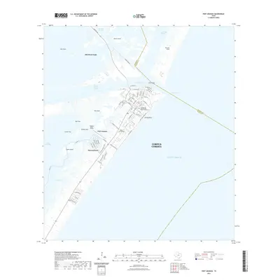
2022 Map of Port Aransas
USGS Topo · Published 2022About this map
Port Aransas sits at the strategic junction of major maritime arteries, where the Aransas Pass connects the Gulf of Mexico to the inland waters of Corpus Christi Bay. This 2022 survey details the dense street grid of the town, featuring landmarks like the Trinity-By-The Sea Episcopal Church Columbarium and the Royal Palm Cem. The landscape is defined by its complex hydrography, with Harbor Island and San Jose Island buffering the mainland from the open sea.
Find a feature on this map
70 named features on this map. Tap any name to fly to it.
Don’t see what you’re looking for? This feature index may not catch every label — zoom into the map to look around manually.
Map Details
Editions of this 2022 Port Aransas Map
This is the sole edition of this map. No revisions or reprints were ever made.
Other maps of this area

1925 · Aransas Pass
USGS Topo · 1:62,500

1950 · Corpus Christi
USGS Topo · 1:250,000

1951 · Crane Islands NW
USGS Topo · 1:24,000

1951 · Allyns Bight
USGS Topo · 1:24,000

1951 · Crane Islands
USGS Topo · 1:62,500

1954 · Aransas Pass
USGS Topo · 1:24,000

1954 · Port Ingleside
USGS Topo · 1:24,000

1954 · Estes
USGS Topo · 1:24,000
1954 · Port Aransas
USGS Topo · 1:24,000

1954 · Aransas Pass
USGS Topo · 1:62,500