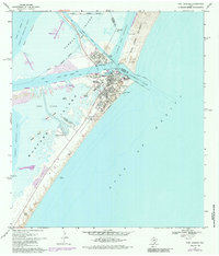
1975 Map of Port Aransas
USGS Topo · Published 1985About this map
Mustang Island and the coastal settlement of Port Aransas dominate this coastal survey, where the dynamic barrier island landscape meets the deep-water channels of the Texas coast. Significant maritime infrastructure is visible, including the Aransas Pass Lighthouse and a dedicated Coast Guard Station guarding the strategic entrance of Aransas Pass. The presence of the Univ of Texas Marine Science Institute and the Horace Caldwell Pier highlights the area's dual identity as a center for research and coastal recreation.
Find a feature on this map
34 named features on this map. Tap any name to fly to it.
Don’t see what you’re looking for? This feature index may not catch every label — zoom into the map to look around manually.
Map Details
Editions of this 1975 Port Aransas Map
This is the sole edition of this map. No revisions or reprints were ever made.
Other maps of this area

1925 · Aransas Pass
USGS Topo · 1:62,500

1950 · Corpus Christi
USGS Topo · 1:250,000

1951 · Crane Islands NW
USGS Topo · 1:24,000

1951 · Allyns Bight
USGS Topo · 1:24,000

1951 · Crane Islands
USGS Topo · 1:62,500

1954 · Aransas Pass
USGS Topo · 1:24,000

1954 · Port Ingleside
USGS Topo · 1:24,000

1954 · Estes
USGS Topo · 1:24,000
1954 · Port Aransas
USGS Topo · 1:24,000

1954 · Aransas Pass
USGS Topo · 1:62,500