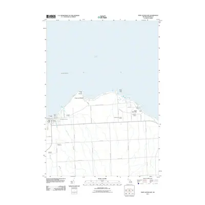
2011 Map of Port Austin East
USGS Topo · Published 2011About this map
The northern tip of Michigan's Thumb is defined here by the rocky protrusion of Pointe aux Barques and the maritime activities centered around Port Austin. This coastal landscape at the start of the 2010s shows a transition from historical industry to modern recreation, with several marinas such as Eagles Marina and Chets Boat Livery serving boaters on Lake Huron. Local history is preserved at the Saint Michael Cemetery and Port Austin Cemetery, while the Grind Stone City Post Office marks a settlement known for its specialized quarrying past. Inland, the terrain is shaped by the drainage of Grant Creek and Bird Creek, with the landscape dedicated to both agriculture and leisure at the Bird Creek Golf Course and Windy Hill Campground. Offshore, the Port Austin Reef Light remains a critical navigational landmark for vessels navigating toward Alaska Bay or Eagle Bay.
Find a feature on this map
46 named features on this map. Tap any name to fly to it.
Don’t see what you’re looking for? This feature index may not catch every label — zoom into the map to look around manually.
Map Details
Editions of this 2011 Port Austin East Map
This is the sole edition of this map. No revisions or reprints were ever made.
Other maps of this area

1954 · Flint
USGS Topo · 1:250,000

1954 · Tawas City
USGS Topo · 1:250,000

1958 · Flint
USGS Topo · 1:250,000

1958 · Tawas City
USGS Topo · 1:250,000

1970 · Port Austin East
USGS Topo · 1:24,000

1970 · Kinde East
USGS Topo · 1:24,000

1970 · Redman
USGS Topo · 1:24,000

1970 · Huron City
USGS Topo · 1:24,000

1970 · Port Austin West
USGS Topo · 1:24,000

1970 · Kinde West
USGS Topo · 1:24,000
Featured Places
- Port Austin, MI
- Dwight Township, MI
- Pointe aux Barques, MI
- Point Aux Barques, MI
- Port Austin Township, MI