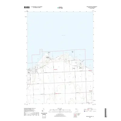
2019 Map of Port Austin East
USGS Topo · Published 2019About this map
Port Austin and the northernmost tip of Michigan's Thumb are documented here along the coast of Lake Huron. This maritime landscape is defined by its rocky points and small harbors, including the distinctive formation at Pointe aux Barques and the coastal settlement of Grind Stone City. The interior terrain is organized by a grid of rural roads and agricultural drainage systems like Cramp Drain and Baranski Drain, which feed into the lake. Historical preservation is evident in the layout of Port Austin Cem and Saint Michael Cem, while the modern utility of the shoreline is noted by Grindstone Air Harbor. The map shows a clear division between the established village streets of Port Austin and the surrounding township, where family-named roads like Crockard Rd and Hellens Rd segment the fields.
Find a feature on this map
57 named features on this map. Tap any name to fly to it.
Don’t see what you’re looking for? This feature index may not catch every label — zoom into the map to look around manually.
Map Details
Editions of this 2019 Port Austin East Map
This is the sole edition of this map. No revisions or reprints were ever made.
Other maps of this area

1954 · Flint
USGS Topo · 1:250,000

1954 · Tawas City
USGS Topo · 1:250,000

1958 · Flint
USGS Topo · 1:250,000

1958 · Tawas City
USGS Topo · 1:250,000

1970 · Port Austin East
USGS Topo · 1:24,000

1970 · Kinde East
USGS Topo · 1:24,000

1970 · Redman
USGS Topo · 1:24,000

1970 · Huron City
USGS Topo · 1:24,000

1970 · Port Austin West
USGS Topo · 1:24,000

1970 · Kinde West
USGS Topo · 1:24,000
Featured Places
- Port Austin, MI
- Dwight Township, MI
- Pointe aux Barques, MI
- Point Aux Barques, MI
- Port Austin Township, MI