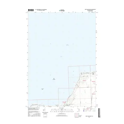
2017 Map of Port Austin West
USGS Topo · Published 2017About this map
Lake Huron and the northern tip of the Thumb region define this coastal landscape, where the waters of Saginaw Bay meet the rocky hazards of the Michigan shoreline. The map documents the interface between the village of Port Austin and the preserved natural lands to the west. A significant portion of the lakebed is detailed with navigationally significant underwater features such as Flat Rock Point Reef and Hat Point Reef, illustrating the maritime environment that shaped this area's history. Inland, the transition from the settlement at Port Crescent to the recreational landscape of the Port Crescent State Park Trail is clear. Local history is anchored by the Port Crescent Cem, located near the intersection of Port Crescent Rd and Port Austin Rd, providing a specific point of interest for genealogists and researchers tracking the vanished industry of the former lumbering town.
Find a feature on this map
28 named features on this map. Tap any name to fly to it.
Don’t see what you’re looking for? This feature index may not catch every label — zoom into the map to look around manually.
Map Details
Editions of this 2017 Port Austin West Map
This is the sole edition of this map. No revisions or reprints were ever made.
Other maps of this area

1954 · Flint
USGS Topo · 1:250,000

1954 · Tawas City
USGS Topo · 1:250,000

1958 · Flint
USGS Topo · 1:250,000

1958 · Tawas City
USGS Topo · 1:250,000
1970 · Rush Lake
USGS Topo · 1:24,000

1970 · Port Austin East
USGS Topo · 1:24,000

1970 · Kinde East
USGS Topo · 1:24,000

1970 · Port Austin West
USGS Topo · 1:24,000

1970 · Kinde West
USGS Topo · 1:24,000

1984 · Harbor Beach
USGS Topo · 1:100,000