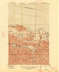
1919 Map of Port Crescent
USGS Topo · Published 1947About this map
Port Crescent and the surrounding coastline of the Strait of Juan de Fuca were surveyed during the First World War, just as the timber industry reshaped the Olympic Peninsula. The landscape transition from the maritime commerce of Freshwater Bay to the interior foothills is evidenced by the presence of early rail infrastructure, including the Milwaukee Road and a Logging RR branching south. Small settlements like Joyce, Ramapo, and Piedmont dot the transport corridors, while educational hubs such as Lower Elwha School and Eden School served these developing communities. To the south, the terrain rises sharply into the Olympic National Park, defined by the peaks of Mt Storm King and Baldy Ridge. This era shows the Elwha River prior to modern shifts, complete with a State Fish Hatchery and the Elwha Ranger Station, reflecting early federal management of these mountain resources.
Find a feature on this map
44 named features on this map. Tap any name to fly to it.
Don’t see what you’re looking for? This feature index may not catch every label — zoom into the map to look around manually.
Map Details
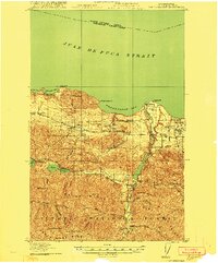
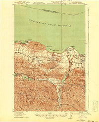
Editions of this 1919 Port Crescent Map
4 editions found
Other maps of this area

1918 · Port Angeles
USGS Topo · 1:62,500

1918 · Lake Crescent
USGS Topo · 1:62,500

1919 · Port Crescent
USGS Topo · 1:62,500

1922 · Lake Crescent
USGS Topo · 1:62,500

1935 · Mount Olympus
USGS Topo · 1:62,500

1938 · Mt Constance
USGS Topo · 1:125,000

1939 · Mount Tom
USGS Topo · 1:62,500

1941 · Port Angeles
USGS Topo · 1:62,500

1942 · Mount Olympus
USGS Topo · 1:62,500

1944 · Mt. Angeles
USGS Topo · 1:62,500