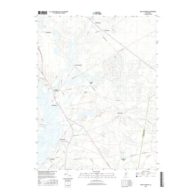
2016 Map of Port Elizabeth
USGS Topo · Published 2016About this map
The Maurice River and Manumuskin River dominate this landscape in southern New Jersey, where several historic riverfront settlements illustrate the region's maritime and industrial heritage. Downstream from the bend at Port Elizabeth, the communities of Bricksboro, Dorchester, and Leesburg line the eastern bank, reflecting a long history of shipbuilding and trade. Further inland, the map captures a network of smaller water bodies and local industry markers, such as Jones Mill, Cumberland Pond, and Hoffmans Mill. The terrain is characterized by low-lying wetlands and minor elevations like Muskee Hill, crossed by historic routes including Old Stage Rd and Hesstown Rd. This survey details the transition from riparian commerce to the more forested interiors of Cumberland and Hesstown, providing a clear look at property access and local landmarks.
Find a feature on this map
66 named features on this map. Tap any name to fly to it.
Don’t see what you’re looking for? This feature index may not catch every label — zoom into the map to look around manually.
Map Details
Editions of this 2016 Port Elizabeth Map
This is the sole edition of this map. No revisions or reprints were ever made.
Other maps of this area

1888 · Dennisville
USGS Topo · 1:62,500

1890 · Tuckahoe
USGS Topo · 1:62,500

1890 · Maurice Cove
USGS Topo · 1:62,500

1890 · Bridgeton
USGS Topo · 1:62,500

1891 · Maurice Cove
USGS Topo · 1:62,500

1893 · Tuckahoe
USGS Topo · 1:62,500

1894 · Dennisville
USGS Topo · 1:62,500

1894 · Bridgeton
USGS Topo · 1:62,500

1899 · Vineland
USGS Topo · 1:125,000

1918 · Tuckahoe
USGS Topo · 1:62,500
Featured Places
- Millville, NJ
- Upper Township, NJ
- Maurice River Township, NJ
- Commercial Township, NJ
- Leesburg, Maurice River Township