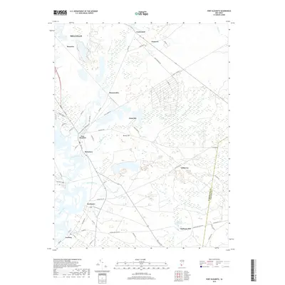
2019 Map of Port Elizabeth
USGS Topo · Published 2019About this map
The Maurice River valley defines this part of South Jersey, where riverfront settlements like Port Elizabeth, Dorchester, and Leesburg have historically relied on the waterway and the nearby glass-sand industry. The map illustrates a landscape of dense wetlands and drainage systems, including Little Mill Creek, Muskee Creek, and the Manumuskin River, which feed into the primary river channel. Small clusters like Bricksboro and Hesstown are connected by a network of rural roads such as Port Elizabeth Cumberland Rd and Hesstown Rd. Evidence of early industry remains visible through sites like Jones Mill and Hoffmans Mill, the latter featuring the significant Hoffmans Mill Pond. The terrain is generally low-lying, with subtle elevations like Muskee Hill rising above the surrounding marshland, while the eastern boundary tracks the transition into Cape May County.
Find a feature on this map
68 named features on this map. Tap any name to fly to it.
Don’t see what you’re looking for? This feature index may not catch every label — zoom into the map to look around manually.
Map Details
Editions of this 2019 Port Elizabeth Map
This is the sole edition of this map. No revisions or reprints were ever made.
Other maps of this area

1888 · Dennisville
USGS Topo · 1:62,500

1890 · Tuckahoe
USGS Topo · 1:62,500

1890 · Maurice Cove
USGS Topo · 1:62,500

1890 · Bridgeton
USGS Topo · 1:62,500

1891 · Maurice Cove
USGS Topo · 1:62,500

1893 · Tuckahoe
USGS Topo · 1:62,500

1894 · Dennisville
USGS Topo · 1:62,500

1894 · Bridgeton
USGS Topo · 1:62,500

1899 · Vineland
USGS Topo · 1:125,000

1918 · Tuckahoe
USGS Topo · 1:62,500
Featured Places
- Millville, NJ
- Upper Township, NJ
- Maurice River Township, NJ
- Commercial Township, NJ
- Leesburg, Maurice River Township