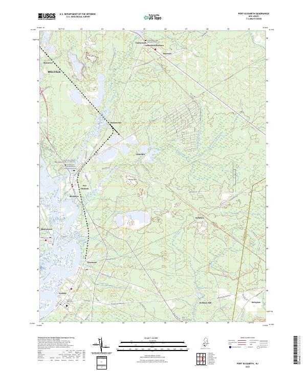
2023 Map of Port Elizabeth
USGS Topo · Published 2023About this map
The Maurice River and its major tributaries, the Manumuskin River and Muskee Creek, define the geography of this coastal plain region. Settlement patterns follow these waterways, with historic centers like Port Elizabeth, Bricksboro, and Leesburg established along the riverbanks. The influence of early religious and community life is visible through several documented burial sites, including the Maurice River Friends Quaker Burial Ground and the Port Elizabeth United Methodist Episcopal Church Cem.
Find a feature on this map
78 named features on this map. Tap any name to fly to it.
Don’t see what you’re looking for? This feature index may not catch every label — zoom into the map to look around manually.
Map Details
Editions of this 2023 Port Elizabeth Map
This is the sole edition of this map. No revisions or reprints were ever made.
Other maps of this area

1888 · Dennisville
USGS Topo · 1:62,500

1890 · Tuckahoe
USGS Topo · 1:62,500

1890 · Maurice Cove
USGS Topo · 1:62,500

1890 · Bridgeton
USGS Topo · 1:62,500

1891 · Maurice Cove
USGS Topo · 1:62,500

1893 · Tuckahoe
USGS Topo · 1:62,500

1894 · Dennisville
USGS Topo · 1:62,500

1894 · Bridgeton
USGS Topo · 1:62,500

1899 · Vineland
USGS Topo · 1:125,000

1918 · Tuckahoe
USGS Topo · 1:62,500
Featured Places
- Millville, NJ
- Upper Township, NJ
- Maurice River Township, NJ
- Commercial Township, NJ
- Jones Mill, Maurice River Township