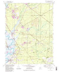
1994 Map of Port Elizabeth
USGS Topo · Published 1998About this map
The Maurice River corridor serves as the primary artery for these South Jersey settlements in the 1990s, where riverine commerce and the regional glass-sand industry shaped the landscape. While Port Elizabeth and Mauricetown retain their historic footprints along the water, the interior reveals a transition toward conservation, dominated by the Peaslee State Wildlife Management Area and Belleplain State Forest. The presence of numerous Gravel Pits and Sand and Gravel Pits north of Dorchester and Leesburg indicates the ongoing importance of mineral extraction to the local economy. Historical infrastructure remains visible through the Cumberland Branch and various sections of Railroad Grade, tracing the paths that once connected inland mills like Hoffmans Mill and Fries Mill to the coastal trade routes. This detailed topographic study preserves the spatial relationship between the maritime villages of Bricksboro and the expansive, low-lying marshes of the Muskee Creek basin.
Find a feature on this map
63 named features on this map. Tap any name to fly to it.
Don’t see what you’re looking for? This feature index may not catch every label — zoom into the map to look around manually.
Map Details
Editions of this 1994 Port Elizabeth Map
This is the sole edition of this map. No revisions or reprints were ever made.
Other maps of this area

1888 · Dennisville
USGS Topo · 1:62,500

1890 · Tuckahoe
USGS Topo · 1:62,500

1890 · Maurice Cove
USGS Topo · 1:62,500

1890 · Bridgeton
USGS Topo · 1:62,500

1891 · Maurice Cove
USGS Topo · 1:62,500

1893 · Tuckahoe
USGS Topo · 1:62,500

1894 · Dennisville
USGS Topo · 1:62,500

1894 · Bridgeton
USGS Topo · 1:62,500

1899 · Vineland
USGS Topo · 1:125,000

1918 · Tuckahoe
USGS Topo · 1:62,500