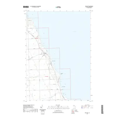
2019 Map of Port Hope
USGS Topo · Published 2019About this map
Port Hope serves as the primary settlement on this shoreline section of Lake Huron, where the grid of State St and Main St meets the coastal highway. The landscape is defined by its relation to the water, featuring a series of distinct maritime landmarks including Whiskey Harbor, Snug Harbor, and Ludingtons Cove. Numerous family-named drains such as Kranz Drain and Karg Drain cut through the interior agricultural plots, reflecting the drainage engineering required for the region's farming history.
Find a feature on this map
52 named features on this map. Tap any name to fly to it.
Don’t see what you’re looking for? This feature index may not catch every label — zoom into the map to look around manually.
Map Details
Editions of this 2019 Port Hope Map
This is the sole edition of this map. No revisions or reprints were ever made.
Other maps of this area

1954 · Flint
USGS Topo · 1:250,000

1954 · Tawas City
USGS Topo · 1:250,000

1958 · Flint
USGS Topo · 1:250,000

1958 · Tawas City
USGS Topo · 1:250,000

1970 · Port Hope
USGS Topo · 1:24,000

1970 · Redman
USGS Topo · 1:24,000

1970 · Huron City
USGS Topo · 1:24,000

1970 · Harbor Beach
USGS Topo · 1:24,000

1970 · Bad Axe SE
USGS Topo · 1:24,000

1984 · Harbor Beach
USGS Topo · 1:100,000