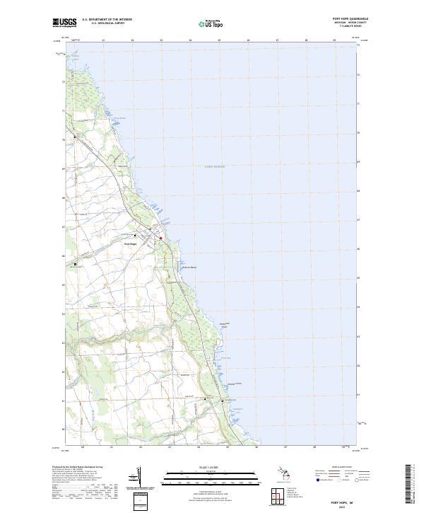
2023 Map of Port Hope
USGS Topo · Published 2023About this map
Port Hope serves as the primary hub along the Lake Huron shoreline in this 2023 survey, showing a network of residential streets including State St, Main St, and Portland Ave. This coastal landscape is defined by its transition from organized agricultural sections to a rocky shoreline characterized by numerous inlets and small bays. The map reveals a high concentration of burial grounds, such as Gore Cem, Port Hope Cem, and Lake View Cem, which provide significant data points for local genealogy. To the south, Rubicon Beach and the marshes near Hardwood Point illustrate the varied shoreline topography. Further south, coastal landmarks like Smokers Point and Ludingtons Cove mark the edge of Lake Huron, while inland drainage features like Ocha Creek and Schmucker Creek cross the township lines of t18n r15e and t17n r15e.
Find a feature on this map
52 named features on this map. Tap any name to fly to it.
Don’t see what you’re looking for? This feature index may not catch every label — zoom into the map to look around manually.
Map Details
Editions of this 2023 Port Hope Map
This is the sole edition of this map. No revisions or reprints were ever made.
Other maps of this area

1954 · Flint
USGS Topo · 1:250,000

1954 · Tawas City
USGS Topo · 1:250,000

1958 · Flint
USGS Topo · 1:250,000

1958 · Tawas City
USGS Topo · 1:250,000

1970 · Port Hope
USGS Topo · 1:24,000

1970 · Redman
USGS Topo · 1:24,000

1970 · Huron City
USGS Topo · 1:24,000

1970 · Harbor Beach
USGS Topo · 1:24,000

1970 · Bad Axe SE
USGS Topo · 1:24,000

1984 · Harbor Beach
USGS Topo · 1:100,000