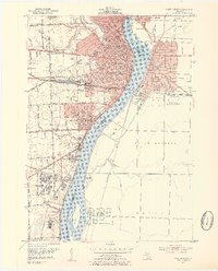
1952 Map of Port Huron
USGS Topo · Published 1954About this map
Port Huron and the neighboring Canadian city of Sarnia anchor this mid-century survey of the international border along the St Clair River. The landscape is defined by heavy industry and infrastructure, from the St Clair Tunnel and Grand Trunk Railway System tracks to the massive Oil Refinery and Oil Tanks south of the Canadian border. The river serves as a bustling corridor of commerce, flanked by the residential growth of South Park and Marysville on the American side and Corunna in Ontario.
Find a feature on this map
77 named features on this map. Tap any name to fly to it.
Don’t see what you’re looking for? This feature index may not catch every label — zoom into the map to look around manually.
Map Details
Editions of this 1952 Port Huron Map
2 editions found
Other maps of this area

1912 · Port Huron
USGS Topo · 1:62,500

1928 · Hicky
USGS Topo · 1:62,500

1929 · Port Huron
USGS Topo · 1:62,500

1936 · St. Clair
USGS Topo · 1:31,680

1936 · Rattle Run
USGS Topo · 1:31,680

1939 · Port Huron
USGS Topo · 1:24,000

1939 · St. Clair
USGS Topo · 1:24,000

1939 · Smiths Creek
USGS Topo · 1:24,000

1942 · Rattle Run
USGS Topo · 1:24,000
1949 · Port Huron
USGS Topo · 1:24,000