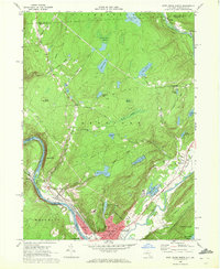
1969 Map of Port Jervis North
USGS Topo · Published 1972About this map
The confluence of the Neversink River and the Delaware River anchors this 1969 survey of the tri-state border region. At the center of this river-and-rail hub, Port Jervis appears in detail, showing a developed street grid including Kingston Ave and Pike St, alongside civic institutions like the West End Sch and Agudath Achim Cem. The Erie Lackawanna Railroad follows the Delaware River shoreline, passing through Sparrow Bush and Germantown, reflecting the area's long history as a transportation corridor. North of the river valley, the terrain rises toward Hawks Nest and the plateau of Deerpark, where a system of municipal reservoirs—Reservoir No. 1, Reservoir No. 2, and Reservoir No. 3—provides water for the growing river town. Settlement patterns follow old routes like Old Plank Road, connecting smaller communities like Cahoonzie and Huguenot to the industrial and commercial center at the valley floor.
Find a feature on this map
75 named features on this map. Tap any name to fly to it.
Don’t see what you’re looking for? This feature index may not catch every label — zoom into the map to look around manually.
Map Details
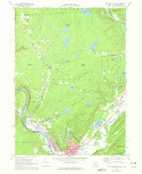
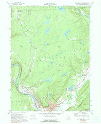
Editions of this 1969 Port Jervis North Map
Other maps of this area

1906 · Port Jervis
USGS Topo · 1:62,500

1908 · Port Jervis
USGS Topo · 1:62,500

1909 · Monticello
USGS Topo · 1:62,500

1911 · Monticello
USGS Topo · 1:62,500

1913 · Milford
USGS Topo · 1:62,500

1915 · Milford
USGS Topo · 1:62,500

1922 · White Lake
USGS Topo · 1:62,500

1942 · White Lake
USGS Topo · 1:62,500

1942 · Port Jervis North
USGS Topo · 1:24,000
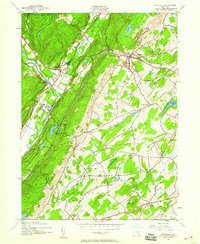
1942 · Otisville
USGS Topo · 1:24,000