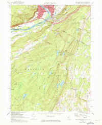
1969 Map of Port Jervis South
USGS Topo · Published 1972About this map
Port Jervis and Matamoras anchor the tri-state junction where the Neversink River meets the Delaware River. This late 1960s survey captures the dense urban core of Port Jervis, featuring St Francis Hospital, St. Marys Cemetery, and the Erie Lackawanna rail lines that once drove the regional economy. Across the river, Mashipacong Island sits in the Delaware, marking the transition into the high ridges of Kittatinny Mountain.
Find a feature on this map
57 named features on this map. Tap any name to fly to it.
Don’t see what you’re looking for? This feature index may not catch every label — zoom into the map to look around manually.
Map Details
Editions of this 1969 Port Jervis South Map
Other maps of this area

1888 · Franklin
USGS Topo · 1:62,500

1891 · Wallpack
USGS Topo · 1:62,500

1893 · Wallpack
USGS Topo · 1:62,500

1894 · Franklin
USGS Topo · 1:62,500

1897 · Franklin
USGS Topo · 1:62,500

1903 · Franklin Furnace
USGS Topo · 1:62,500

1906 · Port Jervis
USGS Topo · 1:62,500

1908 · Port Jervis
USGS Topo · 1:62,500

1913 · Milford
USGS Topo · 1:62,500

1915 · Milford
USGS Topo · 1:62,500