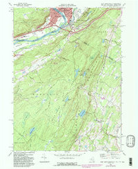
1969 Map of Port Jervis South
USGS Topo · Published 1984About this map
Port Jervis sits at the vital junction of the Delaware River and the Neversink River, serving as a tri-state hub where New York, New Jersey, and Pennsylvania meet. The urban center is dense with mid-century landmarks including St Josephs Ch, Temple Beth-El, and St Marys Ch. Across the river in Pennsylvania, Matamoras is linked by the corridor of the Conrail line and Interstate infrastructure, while the Drive-in Theater reflects the era's recreational landscape.
Find a feature on this map
66 named features on this map. Tap any name to fly to it.
Don’t see what you’re looking for? This feature index may not catch every label — zoom into the map to look around manually.
Map Details
Editions of this 1969 Port Jervis South Map
Other maps of this area

1888 · Franklin
USGS Topo · 1:62,500

1891 · Wallpack
USGS Topo · 1:62,500

1893 · Wallpack
USGS Topo · 1:62,500

1894 · Franklin
USGS Topo · 1:62,500

1897 · Franklin
USGS Topo · 1:62,500

1903 · Franklin Furnace
USGS Topo · 1:62,500

1906 · Port Jervis
USGS Topo · 1:62,500

1908 · Port Jervis
USGS Topo · 1:62,500

1913 · Milford
USGS Topo · 1:62,500

1915 · Milford
USGS Topo · 1:62,500