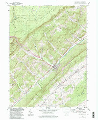
1994 Map of Port Matilda
USGS Topo · Published 1997About this map
Port Matilda sits at the geological crux of the Bald Eagle Valley, where the waters of Bald Eagle Creek separate the massive ridge of Bald Eagle Mountain from the dissected plateaus of the Moshannon State Forest. This 1994 photoinspection reveals a landscape defined by sharp industrial and natural contrasts, from the legacy of iron production at Martha Furnace to the contemporary presence of a Strip Mine and a Quarry.
Find a feature on this map
61 named features on this map. Tap any name to fly to it.
Don’t see what you’re looking for? This feature index may not catch every label — zoom into the map to look around manually.
Map Details
Editions of this 1994 Port Matilda Map
This is the sole edition of this map. No revisions or reprints were ever made.
Other maps of this area

1908 · Bellefonte
USGS Topo · 1:62,500

1909 · Bellefonte
USGS Topo · 1:62,500

1919 · Menno
USGS Topo · 1:62,500

1922 · Philipsburg
USGS Topo · 1:62,500

1923 · Tyrone
USGS Topo · 1:62,500

1929 · Tyrone
USGS Topo · 1:48,000

1933 · Tyrone
USGS Topo · 1:62,500

1935 · Allensville
USGS Topo · 1:62,500

1938 · Allensville
USGS Topo · 1:62,500

1939 · Philipsburg
USGS Topo · 1:62,500