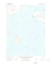
1963 Map of Port Moller A-5
USGS Topo · Published 1975About this map
Pavlof Islands dominate this 1963 survey of the remote Alaskan archipelago, showing the maritime landscape before later developmental shifts. The map details the substantial landmasses of Ukolnoi Island and Wosnesenski Island, along with smaller outcrops such as Poperechnoi Island and Dolgoi Island. The topography focuses on elevation contours and coastal features including Southwest Point and unique landmarks like The Pinnacle.
Find a feature on this map
17 named features on this map. Tap any name to fly to it.
Don’t see what you’re looking for? This feature index may not catch every label — zoom into the map to look around manually.
Map Details
Editions of this 1963 Port Moller A-5 Map
2 editions found
Other maps of this area

1949 · False Pass
USGS Topo · 1:250,000

1950 · False Pass
USGS Topo · 1:250,000

1953 · Port Moller
USGS Topo · 1:250,000

1963 · Port Moller A-5
USGS Topo · 1:63,360
1963 · Port Moller A-4
USGS Topo · 1:63,360

1963 · Port Moller A-6
USGS Topo · 1:63,360
1963 · False Pass D-0
USGS Topo · 1:63,360

1963 · Simeonof Island
USGS Topo · 1:250,000

1967 · Simeonof Island
USGS Topo · 1:250,000

1983 · Port Moller B-6
USGS Topo · 1:63,360