
1983 Map of Port Moller B-3
USGS Topo · Published 1983About this map
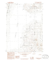
Unga Island and the rugged coastal stretches of the Alaska Peninsula National Wildlife Refuge dominate this 1983 topographic study. The landscape is defined by the proximity of the Pacific Ocean, with the waters of Unga Strait separating the mainland from the island's northern reaches. Grounded in data from 1960s and 1970s aerial photography, the map reveals a wilderness of significant maritime features, from the long protrusion of Unga Spit to the sheltered waters of Zachary Bay. Notable coastal landmarks like Cape Aliaksin and Pinnacle Point serve as critical navigation points along a shoreline where the legal boundary is explicitly noted to follow the mean high water line. This provisional edition preserves the landforms and nomenclature of the Aleutians East region during a period of established federal conservation.
Find a feature on this map
13 named features on this map. Tap any name to fly to it.
Don’t see what you’re looking for? This feature index may not catch every label — zoom into the map to look around manually.
Map Details
Editions of this 1983 Port Moller B-3 Map
2 editions found
Other maps of this area

1953 · Port Moller
USGS Topo · 1:250,000
1963 · Port Moller A-4
USGS Topo · 1:63,360

1963 · Port Moller A-2
USGS Topo · 1:63,360

1963 · Port Moller B-2
USGS Topo · 1:63,360

1963 · Port Moller C-2
USGS Topo · 1:63,360
1963 · Port Moller A-3
USGS Topo · 1:63,360

1983 · Port Moller C-4
USGS Topo · 1:63,360
1983 · Port Moller B-4
USGS Topo · 1:63,360

1983 · Port Moller C-3
USGS Topo · 1:63,360

1988 · Port Moller
USGS Topo · 1:250,000