
1963 Map of Port Moller C-1
USGS Topo · Published 1967About this map
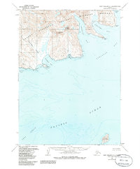
Stepovak Bay and its complex network of fjords and inlets dominate this coastal study along the Alaska Peninsula. The topography is defined by sharp coastal peaks such as Chichagof Peak and Mount Stepo, which separate deep drainages like the Chichagof Valley from the open waters of the Pacific Ocean. A solitary Cabin situated near Orzinski Bay provides evidence of human activity in this maritime landscape. To the south, Karpa Island rises prominently from the Unga Strait, marking the entrance to the bay system. The shoreline is characterized by distinctive nautical landmarks including Waterfall Point, Elephant Point, and Blunt Point, which serve as critical navigation markers between American Bay and Clark Bay. Hydrographic data reveals a seafloor etched with deep troughs, reflecting the glacial origins of the surrounding inlets.
Find a feature on this map
20 named features on this map. Tap any name to fly to it.
Don’t see what you’re looking for? This feature index may not catch every label — zoom into the map to look around manually.
Map Details
Editions of this 1963 Port Moller C-1 Map
2 editions found
Other maps of this area

1951 · Stepovak Bay
USGS Topo · 1:250,000

1953 · Port Moller
USGS Topo · 1:250,000

1963 · Port Moller B-2
USGS Topo · 1:63,360

1963 · Port Moller C-2
USGS Topo · 1:63,360

1963 · Port Moller B-1
USGS Topo · 1:63,360

1963 · Stepovak Bay D-6
USGS Topo · 1:63,360
1963 · Stepovak Bay B-6
USGS Topo · 1:63,360

1963 · Port Moller D-2
USGS Topo · 1:63,360

1963 · Stepovak Bay
USGS Topo · 1:250,000
1963 · Port Moller D-1
USGS Topo · 1:63,360