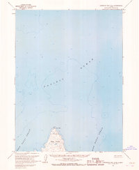
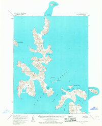
1963 Map of Stepovak Bay B-6
USGS Topo · Published 1967About this map
Nagai Island occupies the southern portion of this mid-century maritime survey, situated where the West Nagai Strait and East Nagai Strait converge. The northern tip of this island is marked by Cape Wedge, a prominent landform that guides vessels transitioning from the open waters of the Pacific Ocean into the straits. A solitary Light is located at this northern extremity, serving as a critical navigational aid for the maritime traffic of the era.
Find a feature on this map
6 named features on this map. Tap any name to fly to it.
Don’t see what you’re looking for? This feature index may not catch every label — zoom into the map to look around manually.
Map Details
Editions of this 1963 Stepovak Bay B-6 Map
2 editions found
Other maps of this area

1951 · Stepovak Bay
USGS Topo · 1:250,000

1953 · Port Moller
USGS Topo · 1:250,000

1963 · Port Moller A-1
USGS Topo · 1:63,360
1963 · Stepovak Bay C-5 and C-6
USGS Topo · 1:63,360

1963 · Port Moller B-1
USGS Topo · 1:63,360

1963 · Port Moller C-1
USGS Topo · 1:63,360
1963 · Stepovak Bay A-6
USGS Topo · 1:63,360
1963 · Stepovak Bay A-5
USGS Topo · 1:63,360

1963 · Stepovak Bay
USGS Topo · 1:250,000

1969 · Stepovak Bay
USGS Topo · 1:250,000