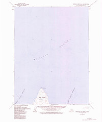
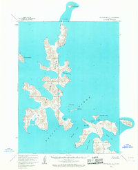
1963 Map of Stepovak Bay B-6
USGS Topo · Published 1984About this map
Nagai Island anchors this maritime survey of the Shumagin Islands area in the Gulf of Alaska. The island's northern tip is defined by Cape Wedge and a coastal Light, serving as a critical waypoint for vessels navigating the passage between the West Nagai Strait and East Nagai Strait. The interior of the landmass is part of the Amnwr, indicating its status as part of the Alaska Maritime National Wildlife Refuge. This 1960s data, updated with 1980s hydrographic details, provides a precise look at the soundings and depths of the surrounding Pacific Ocean, reflecting the region's reliance on maritime navigation and its preservation as a protected wildlife habitat.
Find a feature on this map
7 named features on this map. Tap any name to fly to it.
Don’t see what you’re looking for? This feature index may not catch every label — zoom into the map to look around manually.
Map Details
Editions of this 1963 Stepovak Bay B-6 Map
2 editions found
Other maps of this area

1951 · Stepovak Bay
USGS Topo · 1:250,000

1953 · Port Moller
USGS Topo · 1:250,000

1963 · Port Moller A-1
USGS Topo · 1:63,360
1963 · Stepovak Bay C-5 and C-6
USGS Topo · 1:63,360

1963 · Port Moller B-1
USGS Topo · 1:63,360

1963 · Port Moller C-1
USGS Topo · 1:63,360
1963 · Stepovak Bay A-6
USGS Topo · 1:63,360
1963 · Stepovak Bay B-6
USGS Topo · 1:63,360
1963 · Stepovak Bay A-5
USGS Topo · 1:63,360

1963 · Stepovak Bay
USGS Topo · 1:250,000