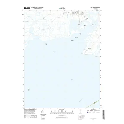
2014 Map of Port Norris
USGS Topo · Published 2014About this map
The maritime identity of Cumberland County is anchored at the mouth of the Maurice River in this 2014 survey. The settlements of Port Norris, Bivalve, and Shell Pile cluster along the riverbanks, their names reflecting the region's historic oyster and fishing industries. To the south, the landscape gives way to the expansive waters of the Maurice River Cove and the Delaware Bay. Coastal features like East Point, Elder Point, and Kenny Point define the marshy shoreline, while the interior is a network of tidal waterways including Dividing Creek, Hansey Creek, and Oranoaken Creek. This study provides a precise look at the low-lying terrain of Maurice River Neck and the isolated community at Thompsons Beach, showing the intricate balance between land and water in a region defined by its proximity to the bay.
Find a feature on this map
43 named features on this map. Tap any name to fly to it.
Don’t see what you’re looking for? This feature index may not catch every label — zoom into the map to look around manually.
Map Details
Editions of this 2014 Port Norris Map
This is the sole edition of this map. No revisions or reprints were ever made.
Other maps of this area

1888 · Dennisville
USGS Topo · 1:62,500

1890 · Tuckahoe
USGS Topo · 1:62,500

1890 · Maurice Cove
USGS Topo · 1:62,500

1890 · Bridgeton
USGS Topo · 1:62,500

1891 · Maurice Cove
USGS Topo · 1:62,500

1893 · Tuckahoe
USGS Topo · 1:62,500

1894 · Dennisville
USGS Topo · 1:62,500

1894 · Bridgeton
USGS Topo · 1:62,500

1899 · Vineland
USGS Topo · 1:125,000

1918 · Tuckahoe
USGS Topo · 1:62,500
Featured Places
- Maurice River Township, NJ
- Commercial Township, NJ
- Downe Township, NJ
- Shell Pile, Commercial Township
- Port Norris, Commercial Township