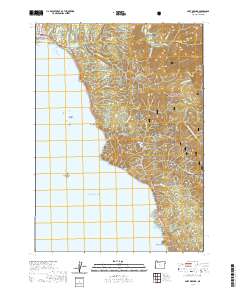
2020 Map of Port Orford
USGS Topo · Published 2020About this map
Battle Rock and the shoreline of the Pacific Ocean dominate this coastal survey of Port Orford. The landscape transitions from the residential street grid of the town, featuring names like Oregon St and Washington St, into the protected wilderness of the Oregon Islands National Wildlife Refuge and Siskiyou National Forest. Dramatic elevation changes are evident at Humbug Mtn and China Mtn, while the interior is drained by the Elk River and its designated Elk Wild and Scenic River corridor. Local history is anchored near the coast at Graveyard Point and Fort Point, with Cemetery Loop Rd providing access to the area's early burial grounds. The map captures a topography where timbered ridges meet the sea, defined by landmarks like Rocky Point and Lookout Rock.
Find a feature on this map
50 named features on this map. Tap any name to fly to it.
Don’t see what you’re looking for? This feature index may not catch every label — zoom into the map to look around manually.
Map Details
Editions of this 2020 Port Orford Map
This is the sole edition of this map. No revisions or reprints were ever made.
Other maps of this area

1899 · Port Orford
USGS Topo · 1:125,000

1903 · Port Orford
USGS Topo · 1:125,000

1954 · Coos Bay
USGS Topo · 1:250,000

1954 · Port Orford
USGS Topo · 1:62,500

1954 · Cape Blanco
USGS Topo · 1:62,500

1954 · Langlois
USGS Topo · 1:62,500

1958 · Coos Bay
USGS Topo · 1:250,000

1962 · Coos Bay
USGS Topo · 1:250,000
1986 · Father Mountain
USGS Topo · 1:24,000
1986 · Ophir
USGS Topo · 1:24,000