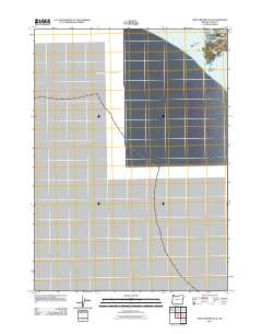
2011 Map of Port Orford OE W
USGS Topo · Published 2011About this map
Port Orford sits at the edge of the Pacific Ocean on this coastal Oregon survey. The shoreline is defined by dramatic geological formations and small coves, ranging from the broad expanse of Agate Beach to the rocky outcroppings of Klooqueh Rock and Tichenor Rock. Behind the coastal bluffs, Garrison Lake provides a freshwater contrast to the salt spray of the nearby surf. This 2011 map documents the town's layout including the Buffington Memorial Park and the historic Tichenor Cemetery, which preserves a link to the early families of Curry County. The topography reveals the sharp descent from the mainland at The Heads down to sea level landmarks like Hells Gate and Nellies Point. These features illustrate the intersection of a settled community and the maritime environment of the Pacific Northwest coast.
Find a feature on this map
12 named features on this map. Tap any name to fly to it.
Don’t see what you’re looking for? This feature index may not catch every label — zoom into the map to look around manually.
Map Details
Editions of this 2011 Port Orford OE W Map
This is the sole edition of this map. No revisions or reprints were ever made.
Other maps of this area

1899 · Port Orford
USGS Topo · 1:125,000

1903 · Port Orford
USGS Topo · 1:125,000

1954 · Coos Bay
USGS Topo · 1:250,000

1954 · Port Orford
USGS Topo · 1:62,500

1954 · Cape Blanco
USGS Topo · 1:62,500

1954 · Langlois
USGS Topo · 1:62,500

1958 · Coos Bay
USGS Topo · 1:250,000

1962 · Coos Bay
USGS Topo · 1:250,000
1986 · Ophir
USGS Topo · 1:24,000
1986 · Cape Blanco
USGS Topo · 1:24,000