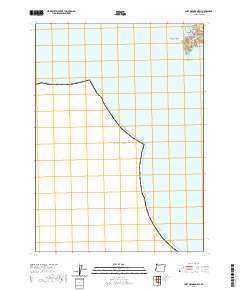
2020 Map of Port Orford OE W
USGS Topo · Published 2020About this map
Port Orford sits at the precipice of the Oregon coastline, where the land fragments into the Pacific Ocean through a series of dramatic promontories and sea stacks. This coastal survey centers on The Heads, a significant landform that shelters Tichenor Cove and Nellies Cove from the open sea. The map documents the intersection of maritime geography and local history, specifically noting the Tichenor Cem and named offshore landmarks like Tichenor Rock and the narrow passage of Hells Gate. While much of the sheet covers the open ocean, the terrestrial portion captures the terminal stretch of the Port Orford Hwy and the grid of the town site near Agate Beach. The mapping of small features like Klooqueh Rock and Nellies Point provides precise data for those studying the enduring and eroding shoreline of Curry County.
Find a feature on this map
15 named features on this map. Tap any name to fly to it.
Don’t see what you’re looking for? This feature index may not catch every label — zoom into the map to look around manually.
Map Details
Editions of this 2020 Port Orford OE W Map
This is the sole edition of this map. No revisions or reprints were ever made.
Other maps of this area

1899 · Port Orford
USGS Topo · 1:125,000

1903 · Port Orford
USGS Topo · 1:125,000

1954 · Coos Bay
USGS Topo · 1:250,000

1954 · Port Orford
USGS Topo · 1:62,500

1954 · Cape Blanco
USGS Topo · 1:62,500

1954 · Langlois
USGS Topo · 1:62,500

1958 · Coos Bay
USGS Topo · 1:250,000

1962 · Coos Bay
USGS Topo · 1:250,000
1986 · Ophir
USGS Topo · 1:24,000
1986 · Cape Blanco
USGS Topo · 1:24,000