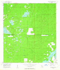
1954 Map of Port Richey NE
USGS Topo · Published 1963About this map
The county line between Hernando and Pasco Counties bisects this landscape of karst topography and prairie wetlands as it appeared in the mid-1950s. The region is defined by its diverse water features, ranging from the large expanse of Crews Lake in the southeast to numerous isolated sinkholes and ponds. Distinctive geologic features like Rock Sink and Coffee Sink dot the central terrain, while the Weekiwachee Prairie and its associated Weekiwachee Prairie Lake illustrate the area's natural drainage patterns. Settlement is sparse in this era, though Loyce Cem provides a specific point of interest for genealogists tracing local families. The map also captures the early footprints of development around Jumping Gully and smaller bodies of water like Hog Pond and Needmore Pond.
Find a feature on this map
19 named features on this map. Tap any name to fly to it.
Don’t see what you’re looking for? This feature index may not catch every label — zoom into the map to look around manually.
Map Details
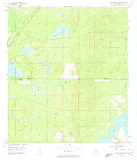
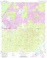
Editions of this 1954 Port Richey NE Map
4 editions found
Other maps of this area

1954 · Ehren
USGS Topo · 1:24,000

1954 · Port Richey
USGS Topo · 1:24,000

1954 · Fivay
USGS Topo · 1:24,000

1954 · Brooksville
USGS Topo · 1:24,000

1954 · Aripeka
USGS Topo · 1:24,000

1954 · Bayport
USGS Topo · 1:24,000

1954 · Masaryktown
USGS Topo · 1:24,000

1954 · Weekiwachee Springs
USGS Topo · 1:24,000

1954 · Port Richey NE
USGS Topo · 1:24,000

1955 · Plant City
USGS Topo · 1:250,000