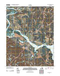
2011 Map of Port Royal
USGS Topo · Published 2011About this map
The Rappahannock River defines the geography of this quadrangle, its winding course punctuated by distinctive river turns like Popcastle Turn and Lagrange Turn. The historic riverside settlements of Port Royal and Port Conway face one another across the water, linked by the James Madison Memorial Bridge. This 2011 survey documents a landscape where agricultural history and prominent estates remain visible, including the Belle Grove and Camden properties. The river’s importance to navigation is evidenced by named reaches and bars such as Slipe Reach and Buckners Reach. Away from the main channel, the map captures a network of rural communities and junctions like Rollins Fork, Office Hall, and Welcome. Local history is anchored by several burial grounds, including Emmanuel Cemetery and Salem Cemetery, while the southern portion of the map extends into the military boundaries of Fort A P HL.
Find a feature on this map
103 named features on this map. Tap any name to fly to it.
Don’t see what you’re looking for? This feature index may not catch every label — zoom into the map to look around manually.
Map Details
Editions of this 2011 Port Royal Map
This is the sole edition of this map. No revisions or reprints were ever made.
Other maps of this area

1889 · Fredericksburg
USGS Topo · 1:125,000

1892 · Fredericksburg
USGS Topo · 1:125,000

1894 · Fredericksburg
USGS Topo · 1:125,000

1926 · Stafford
USGS Topo · 1:62,500

1931 · Stafford
USGS Topo · 1:62,500

1942 · Bowling Green
USGS Topo · 1:31,680

1942 · Upper Zion
USGS Topo · 1:31,680

1942 · Occupacia
USGS Topo · 1:31,680

1942 · Rollins Fork
USGS Topo · 1:31,680

1942 · Port Royal
USGS Topo · 1:31,680