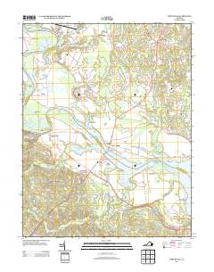
2013 Map of Port Royal
USGS Topo · Published 2013About this map
Port Royal and Port Conway face one another across the Rappahannock River at the site of the James Madison Memorial Bridge, marking a historically significant river crossing. The geography is defined by the winding river channel, creating prominent landforms like Skinkers Neck, Nanzemun Neck, and Goat Island. To the south of the river, Port Royal Cross Roads and the settlement of Lent connect the interior farmland via the Tidewater Trl, while the riverfront is dotted with family-named landings and points such as Berry Plains Lndg and Jiles Point. On the northern bank, the grounds of Belle Grove stand near the river's edge, surrounded by small communities like Milbank, Dogue, and Jersey. The network of creeks and ponds, including Goldenvale Cr and Gouldman Pond, illustrates the hydrology that supported early plantation and agricultural development in this part of Virginia.
Find a feature on this map
111 named features on this map. Tap any name to fly to it.
Don’t see what you’re looking for? This feature index may not catch every label — zoom into the map to look around manually.
Map Details
Editions of this 2013 Port Royal Map
This is the sole edition of this map. No revisions or reprints were ever made.
Other maps of this area

1889 · Fredericksburg
USGS Topo · 1:125,000

1892 · Fredericksburg
USGS Topo · 1:125,000

1894 · Fredericksburg
USGS Topo · 1:125,000

1926 · Stafford
USGS Topo · 1:62,500

1931 · Stafford
USGS Topo · 1:62,500

1942 · Bowling Green
USGS Topo · 1:31,680

1942 · Upper Zion
USGS Topo · 1:31,680

1942 · Occupacia
USGS Topo · 1:31,680

1942 · Rollins Fork
USGS Topo · 1:31,680

1942 · Port Royal
USGS Topo · 1:31,680