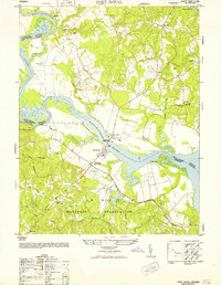
1952 Map of Port Royal
USGS Topo · Published 1952About this map
The Rappahannock River serves as the central artery of this 1952 survey, dividing Caroline and King George counties at a time when riverfront life and military expansion coexisted. The historic village of Port Royal sits directly across from Port Conway, joined by the James Madison Memorial Bridge. This area is characterized by large estates like Camden Farm and smaller agrarian crossroads such as Lent, Etta, and Rollins Fork.
Find a feature on this map
38 named features on this map. Tap any name to fly to it.
Don’t see what you’re looking for? This feature index may not catch every label — zoom into the map to look around manually.
Map Details
Editions of this 1952 Port Royal Map
This is the sole edition of this map. No revisions or reprints were ever made.
Other maps of this area

1889 · Fredericksburg
USGS Topo · 1:125,000

1892 · Fredericksburg
USGS Topo · 1:125,000

1894 · Fredericksburg
USGS Topo · 1:125,000

1926 · Stafford
USGS Topo · 1:62,500

1931 · Stafford
USGS Topo · 1:62,500

1942 · Bowling Green
USGS Topo · 1:31,680

1942 · Upper Zion
USGS Topo · 1:31,680

1942 · Occupacia
USGS Topo · 1:31,680

1942 · Rollins Fork
USGS Topo · 1:31,680

1942 · Port Royal
USGS Topo · 1:31,680