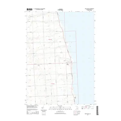
2014 Map of Port Sanilac
USGS Topo · Published 2014About this map
Port Sanilac serves as the focal point of this Sanilac County coastline, where the village grid meets the expansive waters of Lake Huron. The landscape is defined by a dense network of creeks draining into the lake, including Forester Cr, Sherman Cr, and McKenzie Cr, which carve through the rural terrain of townships t12n r16e and t11n r16e. For those tracing local history, several burial grounds are preserved across the area, from Saint Marys Cem and Port Sanilac Cem in the north to Saint John Cem and Ridge Cem further south.
Find a feature on this map
41 named features on this map. Tap any name to fly to it.
Don’t see what you’re looking for? This feature index may not catch every label — zoom into the map to look around manually.
Map Details
Editions of this 2014 Port Sanilac Map
This is the sole edition of this map. No revisions or reprints were ever made.
Other maps of this area

1954 · Flint
USGS Topo · 1:250,000

1958 · Flint
USGS Topo · 1:250,000

1963 · Croswell
USGS Topo · 1:24,000

1963 · Port Sanilac
USGS Topo · 1:24,000

1963 · Applegate
USGS Topo · 1:24,000

1963 · Deckerville
USGS Topo · 1:24,000

1963 · Richmondville
USGS Topo · 1:24,000
1963 · Carsonville
USGS Topo · 1:24,000

1984 · Harbor Beach
USGS Topo · 1:100,000

1984 · Croswell
USGS Topo · 1:100,000