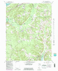
1966 Map of Port Tobacco
USGS Topo · Published 1983About this map
Habre de Venture and Rose Hill anchor the southern landscape of this tidewater region, reflecting the deep-rooted plantation history of Charles County. The map details a transition from the historic colonial port at Port Tobacco to the mid-century suburban expansion around Bryans Road and Green Meadows. The presence of institutions like the Mt Carmel Monastery and Charles County Community College sits alongside established religious centers including St Marys Star of the Sea Sch and St Josephs Ch.
Find a feature on this map
72 named features on this map. Tap any name to fly to it.
Don’t see what you’re looking for? This feature index may not catch every label — zoom into the map to look around manually.
Map Details
Editions of this 1966 Port Tobacco Map
4 editions found
Other maps of this area

1889 · Fredericksburg
USGS Topo · 1:125,000

1890 · Mt. Vernon
USGS Topo · 1:125,000

1891 · Mt. Vernon
USGS Topo · 1:125,000

1892 · Fredericksburg
USGS Topo · 1:125,000

1892 · Brandywine
USGS Topo · 1:62,500

1894 · Wicomico
USGS Topo · 1:62,500

1894 · Fredericksburg
USGS Topo · 1:125,000

1894 · Mt. Vernon
USGS Topo · 1:125,000

1895 · Wicomico
USGS Topo · 1:62,500

1895 · Brandywine
USGS Topo · 1:62,500