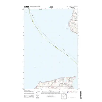
2014 Map of Port Townsend North
USGS Topo · Published 2014About this map
Port Townsend sits at the northern tip of the Quimper Peninsula, overlooking the critical maritime junction of Admiralty Inlet and the Strait of Juan de Fuca. This coastal landscape is defined by its defensive and navigational history, most notably at Fort Worden State Park and the prominent Point Wilson Lighthouse. The map reveals a high concentration of established street grids and landmarks like the Morgan Hill neighborhood and the Jefferson County Fairgrounds.
Find a feature on this map
74 named features on this map. Tap any name to fly to it.
Don’t see what you’re looking for? This feature index may not catch every label — zoom into the map to look around manually.
Map Details
Editions of this 2014 Port Townsend North Map
This is the sole edition of this map. No revisions or reprints were ever made.
Other maps of this area

1939 · Port Townsend
USGS Topo · 1:62,500

1939 · Coupeville
USGS Topo · 1:62,500

1943 · Richardson
USGS Topo · 1:62,500

1943 · Deception Pass
USGS Topo · 1:62,500

1951 · Deception Pass
USGS Topo · 1:62,500

1953 · Coupeville
USGS Topo · 1:24,000

1953 · Nordland
USGS Topo · 1:24,000

1953 · Port Townsend North
USGS Topo · 1:24,000
1953 · Port Townsend South
USGS Topo · 1:24,000
1953 · Gardiner
USGS Topo · 1:24,000