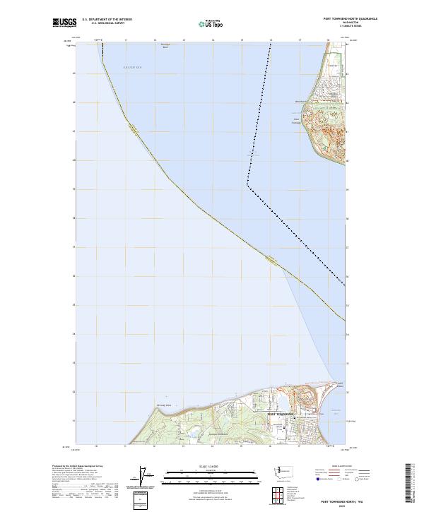
2023 Map of Port Townsend North
USGS Topo · Published 2023About this map
Port Townsend anchors the southeastern corner of this maritime landscape, where the Quimper Peninsula meets the waters of the Admiralty Inlet. This modern survey highlights a region defined by its strategic coastal geography and preserved spaces, including the expansive Ebey's Landing National Historical Reserve on Whidbey Island. Significant local history is preserved at Saint Marys Catholic Cem and the Fort Worden-Military Cem, reflecting the area's long-standing community and military heritage.
Find a feature on this map
67 named features on this map. Tap any name to fly to it.
Don’t see what you’re looking for? This feature index may not catch every label — zoom into the map to look around manually.
Map Details
Editions of this 2023 Port Townsend North Map
This is the sole edition of this map. No revisions or reprints were ever made.
Other maps of this area

1939 · Port Townsend
USGS Topo · 1:62,500

1939 · Coupeville
USGS Topo · 1:62,500

1943 · Richardson
USGS Topo · 1:62,500

1943 · Deception Pass
USGS Topo · 1:62,500

1951 · Deception Pass
USGS Topo · 1:62,500

1953 · Coupeville
USGS Topo · 1:24,000

1953 · Nordland
USGS Topo · 1:24,000

1953 · Port Townsend North
USGS Topo · 1:24,000
1953 · Port Townsend South
USGS Topo · 1:24,000
1953 · Gardiner
USGS Topo · 1:24,000