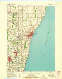
1959 Map of Port Washington
USGS Topo · Published 1960About this map
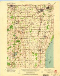
Lake Michigan dominates the eastern boundary of this Ozaukee County landscape, where the lakefront is anchored by the industrial and maritime hub of Port Washington. Inland, the Milwaukee River snakes through the western townships, passing the established centers of Grafton and Cedarburg. The map reveals a post-war rural-to-suburban transition, evidenced by numerous small schoolhouses like Maple Grove Sch and Pleasant Valley Sch still serving crossroads communities, even as larger institutions like Notre Dame of the Lake Sch appear near the southern border in Mequon. Transportation is defined by the dual rail corridors of the Chicago and North Western and the Chicago Milwaukee St Paul and Pacific, which fueled the growth of settlements such as Saukville and Belgium. From the Lighthouse at the harbor to the quiet plots of Old Settlers Rest Cem, the map documents a region balancing its maritime heritage with mid-century growth.
Find a feature on this map
61 named features on this map. Tap any name to fly to it.
Don’t see what you’re looking for? This feature index may not catch every label — zoom into the map to look around manually.
Map Details
Editions of this 1959 Port Washington Map
This is the sole edition of this map. No revisions or reprints were ever made.
Other maps of this area

1892 · Milwaukee
USGS Topo · 1:62,500

1892 · Waukesha
USGS Topo · 1:62,500
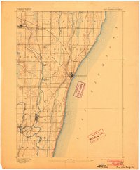
1892 · Port Washington
USGS Topo · 1:62,500

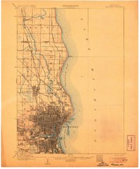
1901 · Milwaukee
USGS Topo · 1:62,500

1901 · Waukesha
USGS Topo · 1:62,500

1904 · West Bend
USGS Topo · 1:62,500
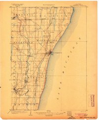
1904 · Port Washington
USGS Topo · 1:62,500

1906 · Waukesha
USGS Topo · 1:62,500
1906 · Milwaukee
USGS Topo · 1:62,500
1954 · Sheboygan Falls
USGS Topo · 1:62,500