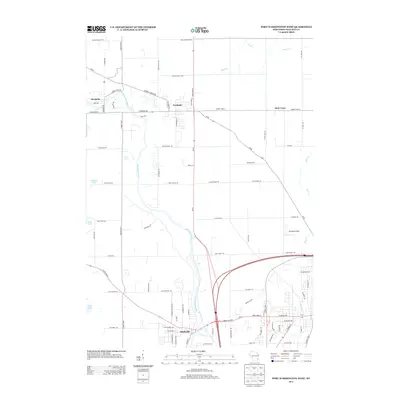
2013 Map of Port Washington West
USGS Topo · Published 2013About this map
The Milwaukee River winds through the heart of this landscape, anchoring a series of river-adjacent settlements including Saukville, Fredonia, and Waubeka. This 2013 survey illustrates the transportation network of Ozaukee County, where the intersection of Wi-57 and several county highways defines the modern footprint of these historic communities. To the east, the rural character remains prominent near the hamlet of Holy Cross and the headwaters of Sauk Cr. The map captures the presence of local aviation at the Ozaukee Airport, situated north of the Milwaukee River's sharp bend. Smaller water bodies like Sandhill Lake and Daly Lake dot the western terrain, reflecting the glacial geography that characterizes this portion of Wisconsin's eastern lakeshore region.
Find a feature on this map
79 named features on this map. Tap any name to fly to it.
Don’t see what you’re looking for? This feature index may not catch every label — zoom into the map to look around manually.
Map Details
Editions of this 2013 Port Washington West Map
This is the sole edition of this map. No revisions or reprints were ever made.
Other maps of this area

1892 · Port Washington
USGS Topo · 1:62,500

1904 · West Bend
USGS Topo · 1:62,500

1904 · Port Washington
USGS Topo · 1:62,500

1954 · Sheboygan Falls
USGS Topo · 1:62,500

1954 · Milwaukee
USGS Topo · 1:250,000

1955 · Kewaskum
USGS Topo · 1:62,500

1957 · Madison
USGS Topo · 1:250,000

1958 · Milwaukee
USGS Topo · 1:250,000
1958 · Port Washington East
USGS Topo · 1:24,000

1959 · Port Washington West
USGS Topo · 1:24,000