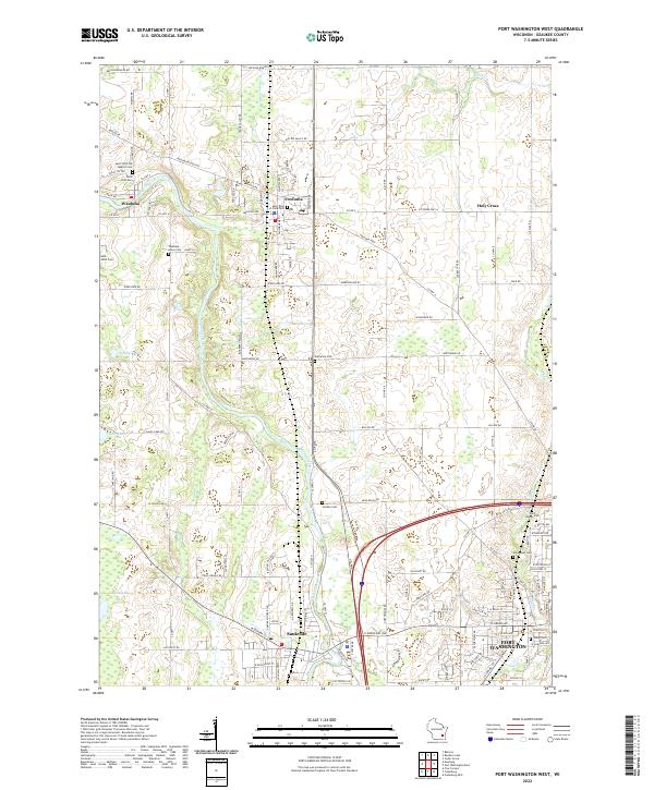
2022 Map of Port Washington West
USGS Topo · Published 2022About this map
The Milwaukee River carves a winding path through this portion of Ozaukee County, anchoring the settlements of Waubeka and Saukville. This landscape is defined by its transition from the dense street grids of western Port Washington to the sprawling natural expanse of the Cedarburg Bog in the southwest. A high concentration of cemeteries, such as Saint John the Baptist Cem and the Norwegian Cem, indicates the deep-rooted immigrant heritage and early parish life that established these communities.
Find a feature on this map
122 named features on this map. Tap any name to fly to it.
Don’t see what you’re looking for? This feature index may not catch every label — zoom into the map to look around manually.
Map Details
Editions of this 2022 Port Washington West Map
This is the sole edition of this map. No revisions or reprints were ever made.
Other maps of this area

1892 · Port Washington
USGS Topo · 1:62,500

1904 · West Bend
USGS Topo · 1:62,500

1904 · Port Washington
USGS Topo · 1:62,500

1954 · Sheboygan Falls
USGS Topo · 1:62,500

1954 · Milwaukee
USGS Topo · 1:250,000

1955 · Kewaskum
USGS Topo · 1:62,500

1957 · Madison
USGS Topo · 1:250,000

1958 · Milwaukee
USGS Topo · 1:250,000
1958 · Port Washington East
USGS Topo · 1:24,000

1959 · Port Washington West
USGS Topo · 1:24,000