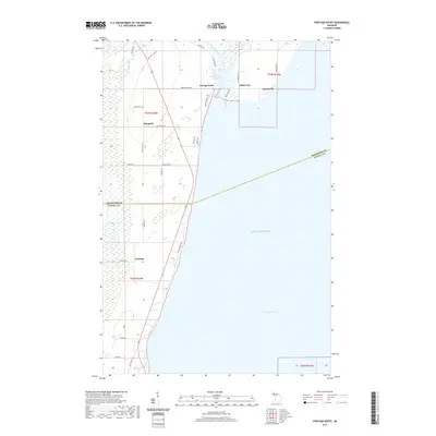
2019 Map of Portage Entry
USGS Topo · Published 2019About this map
Keweenaw Bay and the shoreline of Lake Superior define this coastal landscape on the edge of the Upper Peninsula. The waterway of the Portage River provides a critical passage inland, supported by the Portage River Harbor of Refuge at the mouth of the inlet. Local settlements such as Portage Entry, White City, and Jacobsville are linked by a network of rural routes including Jacobsville Rd and White City Rd. Further south, the community of Arnheim and the small cluster at Klingville sit near the winding course of the Snake River. The map details many named family roads and landmarks like Rautio Trl and Klingville Rd, reflecting the Finnish heritage and timber-influenced settlement patterns of this region before it transitions into the dense wetlands and woods typical of the Copper Country interior.
Find a feature on this map
41 named features on this map. Tap any name to fly to it.
Don’t see what you’re looking for? This feature index may not catch every label — zoom into the map to look around manually.
Map Details
Editions of this 2019 Portage Entry Map
This is the sole edition of this map. No revisions or reprints were ever made.
Other maps of this area

1915 · Houghton
USGS Topo · 1:62,500

1946 · Chassell
USGS Topo · 1:24,000

1948 · Chassell
USGS Topo · 1:24,000

1954 · Traverse Island
USGS Topo · 1:24,000

1954 · Keweenaw Bay
USGS Topo · 1:62,500

1954 · Point Mills
USGS Topo · 1:24,000

1954 · Pelkie
USGS Topo · 1:62,500

1954 · Houghton
USGS Topo · 1:62,500

1958 · Hancock
USGS Topo · 1:250,000

1958 · Iron River
USGS Topo · 1:250,000